
Verified
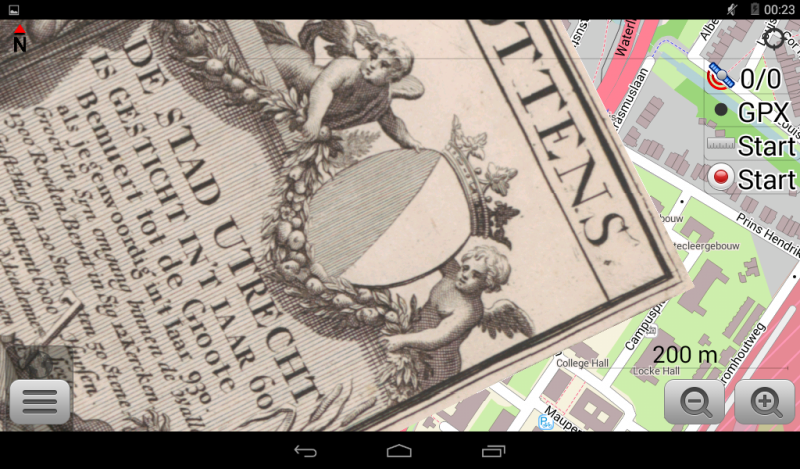
Utrecht 1695
11:20 Mar 6 2015 Utrecht, the Netherlands
Description
The City of Utrecht, map by Caspar Specht and Jan van Vianen.Urbis Traiecti ad Rhenum novissima et accuratissima deliniatio.
Utrecht's ancient city centre features many buildings and structures several dating as far back as the High Middle Ages. It has been the religious centre of the Netherlands since the 8th century. Currently it is the see of the Archbishop of Utrecht, the most important Dutch Roman Catholic leader. Utrecht was the most important city in the Netherlands until the Dutch Golden Age, when it was succeeded by Amsterdam as the country's cultural centre and most populous city.
Additional Data
| year: | 1695 |
| accuracy (m): | 15 |
| map size (Mb): | 250 |
| artist: | Jan van Vianen, Caspar Specht |
| publisher: | Reinier & Josua Ottens |
| wikipedia: | http://en.wikipedia.org/wiki/Utrecht |
| image source: | Rijksmuseum, Amsterdam the Netherlands |
| map download link 1: | www.geotiek.nl/media/Utrecht-1695-jOttensSpecht.zip |
| map download link 2: |
| Credibility: |  |
 |
0 |
Leave a Comment