Verified
Amsterdam 1625
05:00 Mar 17 2015 Amsterdam, the Netherlands
Description
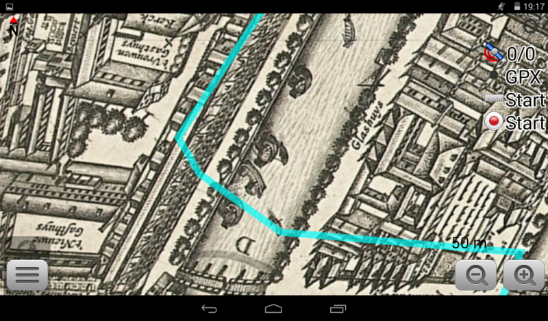
This map is a fantastic work of art, made by Balthasar Florisz. van Berckenrode in 1625.The Map made out of 9 copper plates, holding the etchings with 3 fancy cartouches containing a overview map, a cityscape and a street name register. 7 plates are held by the Rijksmuseum, the other 2 are known to exist in the Bibliotheque Nationale de France (BnF).
The map is also very accurate considering its age and the technology available.
Originating as a small fishing village in the late 12th century. In 1345, an alleged Eucharistic miracle in the Kalverstraat rendered the city an important place of pilgrimage until the adoption of the Protestant faith. Amsterdam became one of the most important ports in the world during the Dutch Golden Age (17th century), a result of its innovative developments in trade.
In the 16th century, the Dutch rebelled against Philip II of Spain and his successors. The main reasons for the uprising were the imposition of new taxes, the tenth penny, and the religious persecution of Protestants by the Spanish Inquisition. The revolt escalated into the Eighty Years' War, which ultimately led to Dutch independence. Strongly pushed by Dutch Revolt leader William the Silent, the Dutch Republic became known for its relative religious tolerance. Jews from the Iberian Peninsula, Huguenots from France, prosperous merchants and printers from Flanders, and economic and religious refugees from the Spanish-controlled parts of the Low Countries found safety in the Netherlands. The influx of Flemish printers and the city's intellectual tolerance made Amsterdam a centre for the European free press.
The 17th century is considered Amsterdam's Golden Age, during which it became the wealthiest city in the world. Ships sailed from Amsterdam to establish trading posts in the Baltic area, North America, Brazil, along the African coast, India, Sri Lanka and Indonesia and Japan, creating a worldwide trading network. Amsterdam's merchants had the largest share in both the Dutch East India Company and the Dutch West India Company. These companies acquired overseas possessions that later became Dutch colonies. Amsterdam was Europe's most important point for the shipment of goods and was the leading Financial Centre of the world. In 1602, the Amsterdam office of the Dutch East India Company became the world's first stock exchange by trading in its own shares. During that time, the city was the leading center for finance and diamonds.
Amsterdam's prosperity declined during the 18th and early 19th centuries. The wars of the Dutch Republic with England and France took their toll on Amsterdam. During the Napoleonic Wars, Amsterdam's significance reached its lowest point, with Holland being absorbed into the French Empire. However, the later establishment of the United Kingdom of the Netherlands in 1815 marked a turning point.
Amsterdam draws more than 3.6 million international visitors annually, its main attractions include;
the historic canals (a UNESCO World Heritage item),
the Rijksmuseum,
the Van Gogh Museum,
Stedelijk Museum,
Hermitage Amsterdam,
Anne Frank House,
Amsterdam Museum,
the red-light district and its many cannabis coffee shops.
Additional Data
| year: | 1625 |
| accuracy (m): | 10 |
| map size (Mb): | 800 |
| artist: | Balthasar Florisz. van Berckenrode |
| publisher: | Balthasar Florisz. van Berckenrode |
| wikipedia: | http://en.wikipedia.org/wiki/Amsterdam |
| image source: | Rijksmuseum, Amsterdam the Netherlands |
| map download link 1: | www.geotiek.nl/media/Amsterdam-1625-bvanBerckenrode.zip |
| map download link 2: |
| Credibility: |  |
 |
0 |
Leave a Comment