Verified
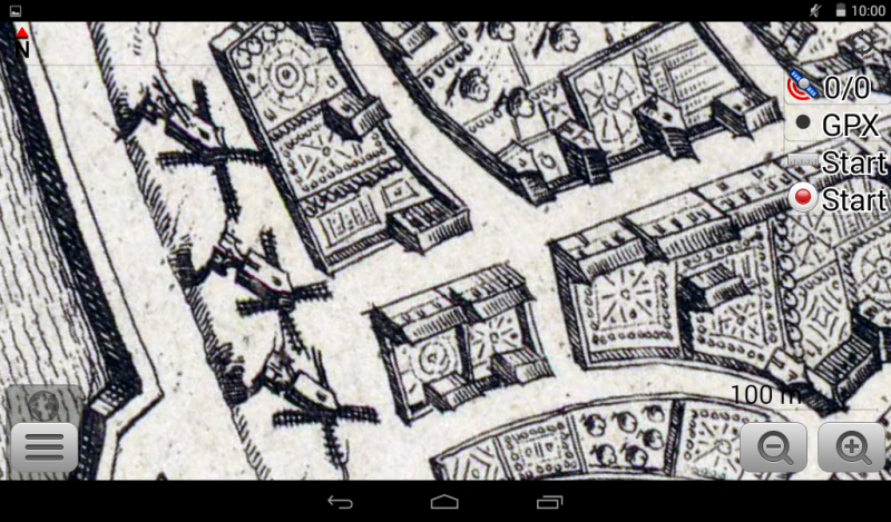
Brugge 1700
12:23 Mar 26 2015 Bruges, Belgium
Description
Father and son Stridbeck were the first significant atlas publishers in German speaking countries and made many maps and topographical works. This map may stem from the publication: "Curiose Staats und Kriegs Theatrum" with stitches on current wars in multiple editions or "Beruffene Laender, Gegenden, Staedte, Plaetze und Oerter" published 1712 in Augsburg.In the 9th century, as a defense against the attacking Normans, Baldouin II the Bald built a fortress on the only bridge surviving from Roman times, it was this that probably gave the site its name. In the 12th century Bruges rose to become a major center of European trade, after a flood left the city with direct access to the nearby North Sea.
Bruges received its charter in 1128.
As a center of Flemish cloth production, towards 1200 Bruges began holding trade fairs, at which wool imported from England was also sold. The first stock exchange was born at the inn run by the van der Buerse family of merchants, who subsequently gave their name to the concept of the "bourse" itself. In the 15th century Bruges saw a flowering of the arts: major artists such as the Van Eyck brothers, Hans Memling and Gerard David lived and worked here."
Additional Data
| year: | 1700 |
| accuracy (m): | 100 |
| map size (Mb): | 350 |
| artist: | Johann Stridbeck der Jüngere |
| publisher: | Johann Stridbeck der Jüngere |
| wikipedia: | http://en.wikipedia.org/wiki/Bruges |
| image source: | Wikimedia, Bibliothèque nationale de France |
| map download link 1: | B-Brugge-1700-jStridbeckJunior.zip |
| map download link 2: |
| Credibility: |  |
 |
0 |
Leave a Comment