Verified
Leeuwarden 1603
22:40 Jan 1 2015 Leeuwarden, the Netherlands
Description
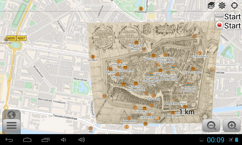
Great GPS-map of Leeuwarden in birdseye perspective, by Pieter Bast from the famous Plantin printing family. The area has been occupied since the 10th century and was granted a town charter in 1435. Situated along the Middelzee, it was an active trade centre, until the waterway silted up in the 15th century. Famous natives of Leeuwarden include stadtholder William IV of Orange, graphic artist M. C. Escher, and dancer-spy Mata Hari.Additional Data
| year: | 1603 |
| accuracy (m): | 25 |
| map size (Mb): | 150 |
| artist: | Pieter Bast (ca 1550 – 17 March 1605) |
| publisher: | Pieter Bast (ca 1550 – 17 March 1605) |
| wikipedia: | http://en.wikipedia.org/wiki/Leeuwarden |
| image source: | Rijksmuseum, Amsterdam the Netherlands |
| map download link 1: | Leeuwarden-1603-pBast.zip |
| map download link 2: | deze |
| Credibility: |  |
 |
0 |
Leave a Comment